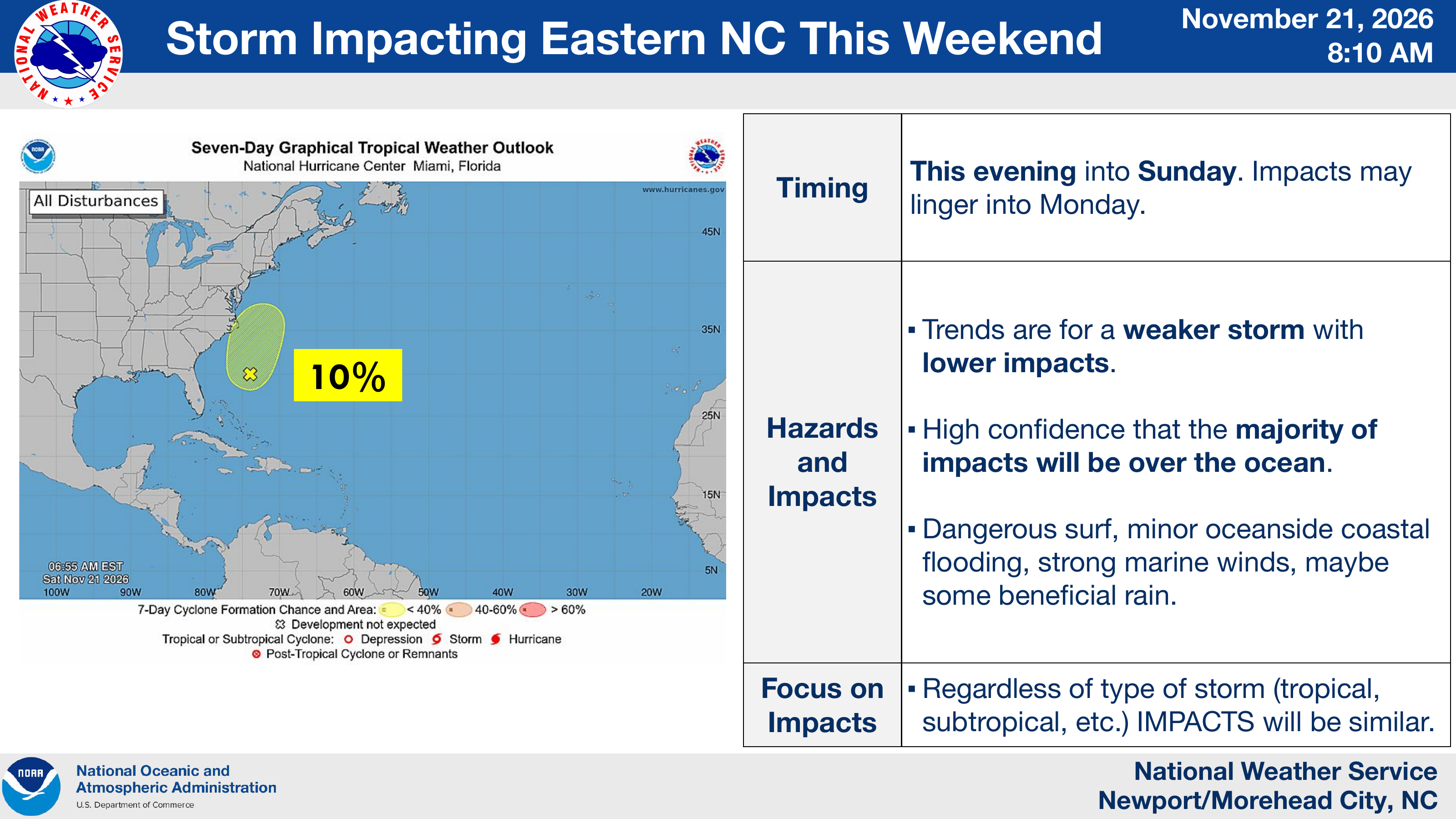
This morning’s NWS briefing shows another significant decrease in tropical development odds: the seven-day probability has dropped from 40% yesterday afternoon to 10% today. Forecasters continue to expect a weaker storm with lower impacts and have high confidence that most impacts will remain over the ocean.
Impacts are expected this evening into Sunday, with some effects possibly lingering into Monday. Dangerous surf, minor oceanside coastal flooding and strong marine winds remain possible. The NWS says there may also be some beneficial rain.
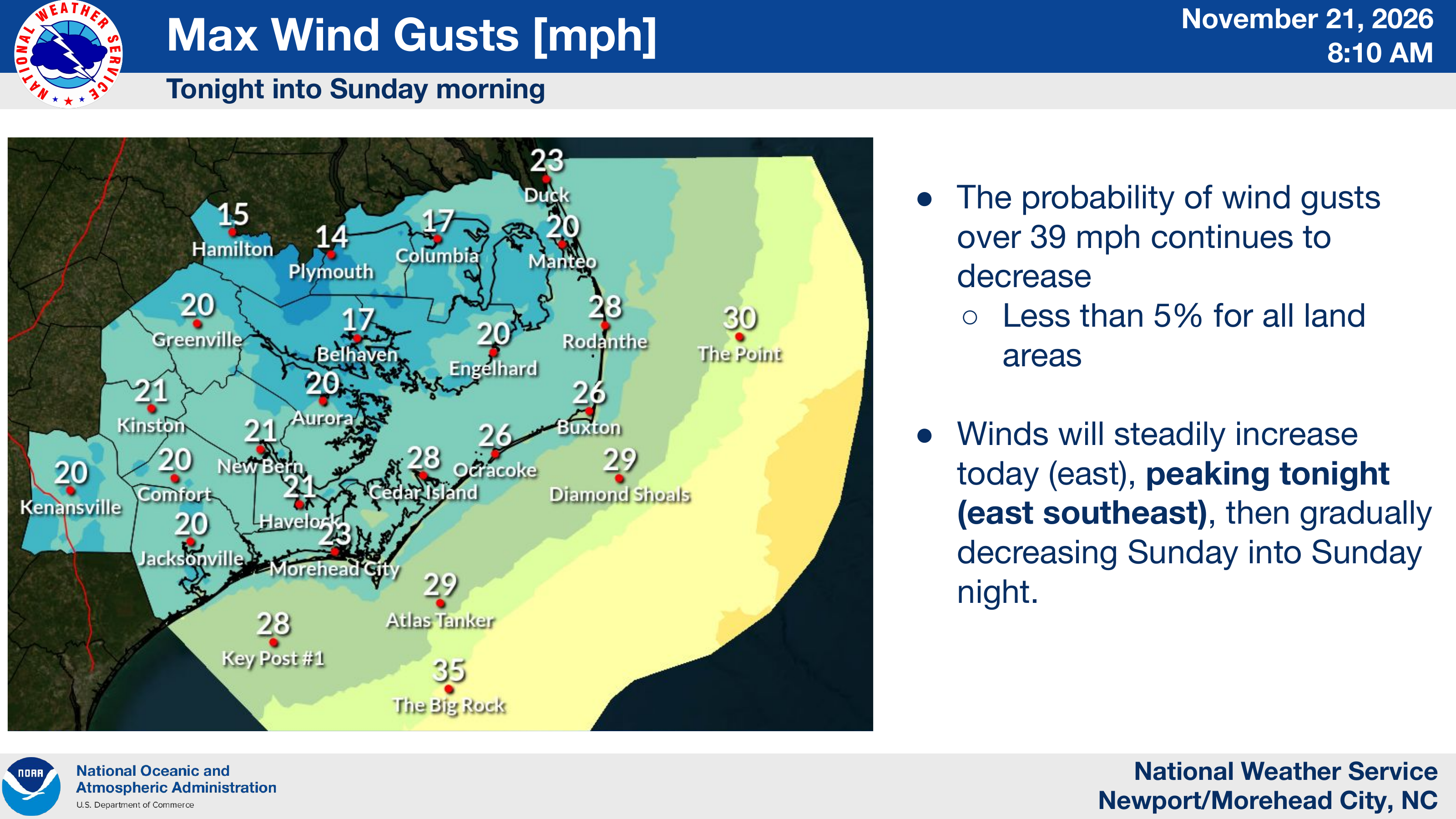
The wind threat has decreased further. The chance of wind gusts exceeding 39 mph is now less than 5% for all land areas. Winds are expected to peak tonight from the east-southeast, then gradually decrease Sunday into Sunday night.
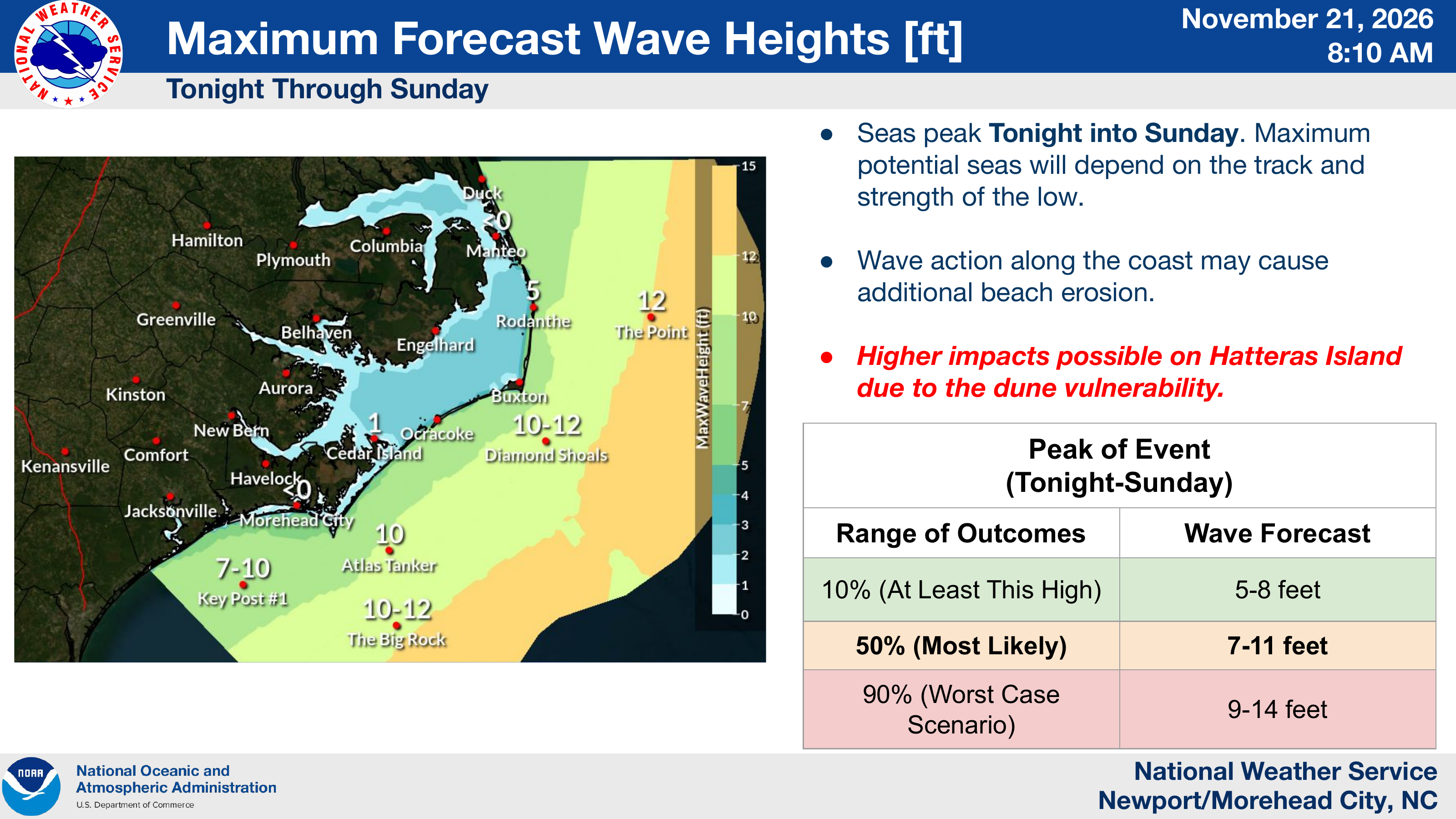
Wave-height forecasts are unchanged from yesterday: most likely 7–11 feet, with a worst-case range of 9–14 feet. Seas are expected to peak tonight into Sunday, and additional beach erosion remains possible, particularly along vulnerable dunes on Hatteras Island.
Source & credit
Credit: National Weather Service Newport/Morehead City, NC.