

|
|
|
Coastal Storm Threat
March
Eastern North Carolina
Threat Assessment
National Weather Service
Newport/Morehead City, NC
Date/Time Created: 03/06/14, 4:30 PM
Threat Summary
•Low pressure will move from off the north Florida coast this evening to just off
the North Carolina coast late Friday. Gale force northeast winds will develop this evening and continue into Friday night. As the low begins to slide east of the coast later Friday and Friday night, winds will become more northerly. Wind advisories for winds of 25 to 35 mph with gusts to 45 mph are in effect for Carteret County and the Outer Banks through 7 am Saturday morning.
•The strong winds will create large waves with high surf conditions through Friday night, mainly from Cape Lookout north. The prolonged strong winds will also lead to increased water levels over the southern Pamlico Sound and ocean side beaches north of Cape Hatteras. Water levels are expected to reach 2 to 3 feet above normal, producing mainly minor coastal flooding. Coastal Flood Advisories remain in effect into Saturday morning for oceanside north of Cape Hatteras and for the southern Pamlico Sound.
•The increased water levels and high surf may lead to some ocean
• Rain will be moderate to heavy at times. Total rainfall amounts will range from one to two inches across most of eastern North Carolina with the heaviest amounts along the Crystal Coast.
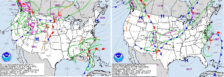
Weather Maps
7 PM Thursday |
7 PM Friday |
Low pressure will deepen as it lifts north along the coast from Florida to North Carolina tonight and Friday.
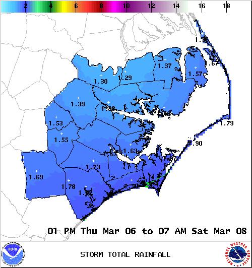
Rainfall Forecast
Rainfall forecast through Saturday morning – 1.5 to 2 inches in most areas with locally heavier amounts possible.
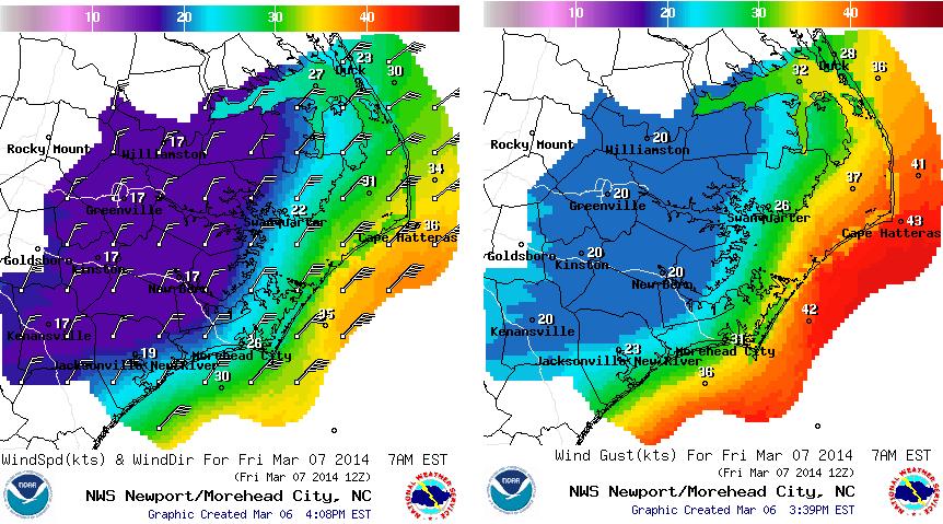
Wind Speed and Gusts (kts)
Wind speed (knots) and direction |
Max Wind Gusts (knots) 7 AM Friday |
|
7 AM Friday |
||
|
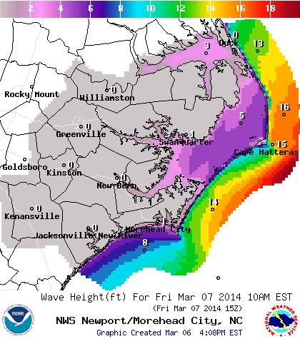
Wave Height Forecast (ft)
Wave Height forecast 10 AM Friday – as high as 20 feet off the Outer Banks.
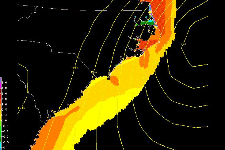
Coastal Flooding/Storm Surge
Storm Surge forecast valid Friday evening
Water level rises of
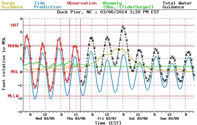
Duck Pier
Coastal Water Forecast
Note the increase in surge tonight into Friday. Max water levels expected Friday night.